
California Neighbor Searches Start at the Block
A useful California neighbor lookup answers a narrow question: which parcels touch the mapped parcel, and what public record belongs to each one? It does not reveal everyone who visits, lives at, or receives mail at those addresses. California has no single state parcel map or public block roster. Each county controls its assessor and GIS tools, and local cities keep many permits, maps, and community records.
These sources describe different parts of a block. The table keeps the land record, title record, and community record separate so an owner name is not mistaken for a list of neighbors.
| Source | What It Shows Nearby | Access route |
|---|---|---|
| County GIS parcel viewer | Parcel edges, adjacent APNs, situs labels, and selected map layers | County or city map site; layer names vary |
| County assessor record | Assessment fields and owner information where the county releases it | Online portal, counter, or permitted office request |
| County recorder index | Named parties and dates on recorded title documents | Online index where available, public terminal, mail, or counter |
| Qualified voter file | Specified registration fields for an allowed research purpose | Formal Secretary of State or county application |
| City and community records | Public maps, plans, meeting records, and association contact details | Clerk, planning, neighborhood-services, or official group page |
| Library and archive holdings | Dated directories, surveys, maps, or neighborhood history | Catalog, digitized collection, or reading room |
A map can show adjacency. An assessor may show a public owner or mailing relationship. A deed can establish that a named party took part in a recorded transfer. None of these sources proves that the listed person is a current neighbor, and a voter file is not an ordinary way to fill the gap.
Map Parcels Around California Neighbors
Start with one address and follow the parcel map outward. The APN, or assessor parcel number, is the stable key for returning to the same mapped property when street labels differ. The exact click tools and layer names depend on the California county viewer. Record the map date and search scope as you go.
Address → locate the parcel → note adjacent APNs and situs labels → open each parcel separately → check the matching assessor or recorder record.
- Search the subject address in the county parcel map. If the first result fails, try the portal’s normalized street spelling and check the nearby address point.
- Turn on parcel boundaries and labels, then note the APN and situs label for each parcel that shares a boundary with the subject.
- Open each adjacent parcel on its own. Keep its owner field, mailing address, and assessment details tied to that parcel rather than carrying conclusions across the block.
- For a full named-street sequence, use the California street directory method and its assessor-to-recorder steps.
Do not infer people from a shared driveway, a common mailbox, or one map label. An APN gives a map unit for the search, not the number of households or a complete list of neighbors.
Sacramento Parcel Viewer Shows Map Context
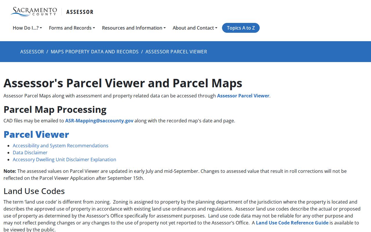
The Sacramento County Assessor Parcel Viewer is one inspected California starting point for parcel boundaries and assessment context. It is an example for Sacramento County, not a statewide map service. Use the live viewer for a current search and read its update notice before relying on a map layer.
The Sacramento parcel viewer page shows the county map entry point. It can help a researcher locate adjoining parcels and choose map layers, but the map does not identify every person at an address.
Useful layers may include parcel boundaries and labels, address points, building footprints, zoning or land use, assessor districts, flood or fire zones, and city boundaries. Counties name and operate these layers differently. Record which ones were visible, the date, and the scale so the map can be checked again.
California Assessor Details Differ by County
Owner visibility is not consistent across California. The Sacramento assessor records page lists fields such as APN, property and mailing addresses, values, exemptions, tax-rate area, zoning and land-use codes, recorder book and page, parcel maps, and property characteristics. Its public page says owner information is not shown online. The office describes phone, email, public-counter, and self-service access for address or parcel questions, with phone or email requests limited to two parcels per day.
The Los Angeles Assessor mapping guidance explains why unrestricted owner-name search is not available on the public web and notes match risks for corner, multifamily, commercial, and new-development addresses. Those county-specific limits affect how a California neighbor search should be interpreted.
These assessor fields can help compare adjacent APNs, but they do not show guests, visitors, a full household, or a reliable date of occupancy. Keep owner name and owner mailing address in separate notes. Verify each fact against the county office that holds it.
California Voter Files Have Strict Limits
The Secretary of State’s voter-status tool lets a voter check their own registration, registered name, party preference, polling place, or ballot information after an exact identity match. It is not an address search for a neighbor. A county elections office can answer precinct or district questions through the routes listed by the state.
Qualified requestors may apply for a statewide file, a county file, or a limited file for specific voters when the purpose is allowed. The voter-file instructions ask for the requester’s identity, purpose and intended use, government photo ID, and a wet signature; submission is by mail or in person, not by email or fax. Fields and fees depend on the file type and current instructions.
Even an approved file is a dated registration record. Protected voters, confidential records, or inactive records may not appear as expected. A voter file does not prove current residence, physical presence, family ties, or that anyone voted a particular way. California voter data cannot be used as a casual block roster or requested through a generic PRA request.
California Community Sources, Not Rosters
California has no official statewide registry of neighborhood associations. Local community records are spread across city offices and each group’s own public contact channel. Since the research did not identify a statewide list of particular groups or member directories, the reliable next step is to ask the local custodian where public maps, agendas, or community pages are kept.
These routes can establish who administers a local record or how a public group describes its area. They do not turn an association into an address-by-address people search.
| City clerk | Public meeting agendas, minutes, local records, and referral to the correct department. |
|---|---|
| Neighborhood-services or council office | Public service boundaries, contact pages, and local planning information where published. |
| Planning department | Neighborhood plans, subdivision maps, historic-district surveys, and land-use records. |
| Official association page | Public contact details or meeting information; membership lists are not ordinarily public. |
| Library or historical society | Archived newsletters, maps, local directories, and dated neighborhood history, subject to collection rules. |
Homeowners’ association covenants may appear in recorded documents, while a public contact page may name an association or manager. Neither normally discloses all members. Chamber, cultural-district, business-improvement, and historical-society lists describe organizations and places, not all residents nearby.
California Block Maps Need Dates and Legends
Parcel lines do not define every neighborhood. A block label can overlap ZIP codes, Census tracts, city council districts, school or service areas, and informal neighborhood names. A route “across the street” may cross a city line even when the two parcels look close on a screen. Treat each boundary as the map’s stated geography, not as a universal community border.
For community context, look for public meeting agendas, neighborhood plans, historic-district surveys, subdivision maps, and city council records. California libraries and historical societies can hold older maps or archived newsletters. Record the title, date, page or volume, and restriction; a historical newsletter may describe a group’s work but does not authorize copying private member names.
When saving a map image for personal research, include the county, search date, map scale, and visible legend. Keep the layer names with the APNs reviewed. That small record makes a California block comparison repeatable when the county updates a parcel layer or changes its viewer.
Official Records Versus Compiled Neighbor Profiles
Different tools can place a name beside an address, but the source and date determine what the result means. Official custodians show their own parcel, assessment, or recorded-document fields. Commercial compiled profiles may merge older addresses and public-record fragments. Use the category comparison below to judge what needs confirmation, without treating either output as a household list.
| Record type | What it can support | What still needs checking |
|---|---|---|
| County GIS or assessor map | Mapped APNs, boundaries, situs labels, and selected assessment details | Current occupancy, every person at the parcel, and legal boundary questions |
| County recorder index | A recorded party, instrument type, and recording date within that county’s coverage | Whether an instrument transfers title and whether a named party lived there |
| Commercial compiled profile | A lead that may point to a past address or public source | Source date, county coverage, name match, and whether the address is current |
A compiled result is not an official California county record. Check its source trail against the custodian and note gaps before drawing a conclusion. Never present a name-and-address match as proof that someone is a current neighbor.
California Neighbor Research Has Privacy Limits
Some address data is intentionally withheld. California limits voter-file use, protects certain public-official addresses, and offers eligible people a confidential-address option through the Secretary of State’s Safe at Home program. A substitute mailing address does not erase a land record, and a researcher should never try to infer a protected location from parcel details.
Motor-vehicle records are restricted by federal and state law. Utility accounts, school records, delivery data, and emergency-service information are not public neighborhood directories. A missing result can reflect a legal limit or a different custodian, rather than a missing neighbor.
Lawful personal use. Use California parcel and community records for a legitimate personal, historical, or civic question. Do not follow, expose, intimidate, stalk, or harass anyone based on a record match.